Tyler expected to see more rain Friday, Saturday
Published 5:13 pm Thursday, March 10, 2016
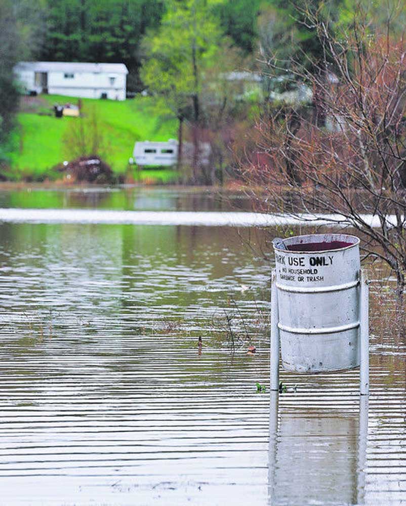
- A trash receptacle is surrounded by water at Lake Tyler East Side Park on Thursday, March 10, 2016, near Chapel Hill, Texas. Several cities and counties in East Texas are under disaster declarations in the wake of ongoing heavy thunderstorms which moved through the area. (Andrew D. Brosig/Tyler Morning Telegraph via AP)
Tyler and the surrounding area is expected to see more rain Friday and Saturday, although meteorologists say the showers are expected to be lighter and more scattered than the heavy storms that caused widespread damage across the area.
The National Weather Service estimates Tyler could receive 1 to 2 more inches of rain before the storm has worked its way out of East Texas.
Trending
KYTX CBS19 Meteorologist Doc Deason said East Texans should expect to see conditions drying out on Sunday.
“We will probably see some additional showers … early morning Friday,”Deason said. “(For Friday) It doesn’t look as widespread as we have had … some scattered showers on Saturday. As we get closer into Sunday, there will be less with a lower chance of rain on Sunday, 20 percent or less.”
Tyler has seen a total of 8.53 inches of rainfall, as of 3 p.m. Thursday, since the rain began Tuesday. Deason said viewers had reported rainfall totals of as much as 15 inches in the Toledo Bend area.
On Thursday, Tyler joined a list of area municipalities to issue disaster declarations due to the recent heavy rain. Longview, Kilgore and Gregg County issued declarations Wednesday.
The heavy rainfall in Tyler caused trees to lose ground and creeks to overflow, as well as possible damage to parks, roadways and wastewater.
City officials said creeks and channels suffered erosion from swift waters, but the scope of damage still was unknown Thursday.
Trending
“Total damages have yet to be assessed as the flood waters have not receded in certain parts of the city,” said Fire Chief Tim Johnson. “All departments are working tirelessly to make sure roads and services remain operational.
“As rain continues to fall, the impact to public infrastructure will grow,” Johnson added. “Staff continues to respond to issues throughout the city and is calculating damages.”
The most severe damage was in Gregg County, which saw more than 9 inches of rain at the East Texas Regional Airport in Longview.
Heavy flooding Wednesday caused the city of Kilgore to issue a mandatory evacuation order for many neighborhoods. Officials with the Kilgore Emergency Operations Center performed about two dozen water rescues and more than 70 evacuations.
With many roads throughout East Texas damaged or still flooded, authorities conintue to urge drivers to take caution.
Twitter: @TMT_Cory
SMITH COUNTY ROAD CLOSURES
The following roads are closed until further notice. These roads are washed out and need a culvert or bridge repaired or replaced. DO NOT drive over these roads:
• CR 165 between CR 166 & FM 2493
• CR 132 between CR 135 & CR 1230
• CR 233 between CR 234 & FM 850
• CR 247 between CR 246 & CR 223
• CR 448 between CR 446 & FM 1805
• CR 434 between CR 436 & CR 4184
• CR 499 between CR 4102 & CR 498
The following roads still have HIGH WATER over them. These roads are not closed but the Road and Bridge Department does not recommend driving over them at this time. Road workers say they will not know the condition of the roads until the water subsides.
• CR 455
• CR 420
• CR 421
• CR 113
• CR 129
• CR 2106
• CR 354
• CR 3104
• CR 3111
• CR 356
• CR 2138
• CR 2180
• CR 484
Road and Bridge crews worked all day on Wednesday, March 9, 2016, to repair a washed out culvert on County Road 419 in Northwestern Smith County, so residents could drive on the dead-end road to get in and out of their property. The road is only one lane right now but is drivable.

-
eEdition
-
-
