Tropical Bill will bring heavy rain and possible isolated tornadoes
Published 1:18 pm Tuesday, June 16, 2015
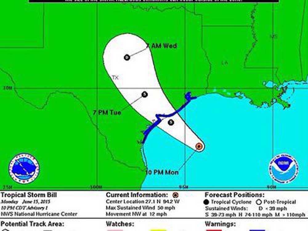
- PHOTO: NWS
Tropical Storm Bill is set to make landfall tonight on the Texas Gulf Coast and if the current track holds, National Weather Service forecasters say East Texas could receive two to three inches of rain.
However, the greater risk for the area could be isolated tornadoes spawned by the tropical air mass meeting drier air.
Trending
Mario Valverde, NWS Shreveport meteorologist, said the current track means heavier rainfall totals for southwest of the Dallas-Fort Worth area.
“Of course this track could shift a little more either way and if it moves more to the right, the the East Texas area could see more than 8.8 inches of rain over the next several days,” he said.
Valverde said the expected rainfall could spell disaster as there is a good possibility of a repeat of the May flooding in DFW.
“In your area there is a greater risk of potential tornadoes as they are typically to the right of a system like this one,” he said.
Just moments later the NWS issued a tornado watch for the entire East Texas region along with a flash flood watch.
At 9:20 a.m. TS Bill was about 155 miles from the Galveston coast.
Trending

-
eEdition
-
-
