Beryl brings heavy rain, severe storms to East Texas
Published 8:30 am Wednesday, July 10, 2024
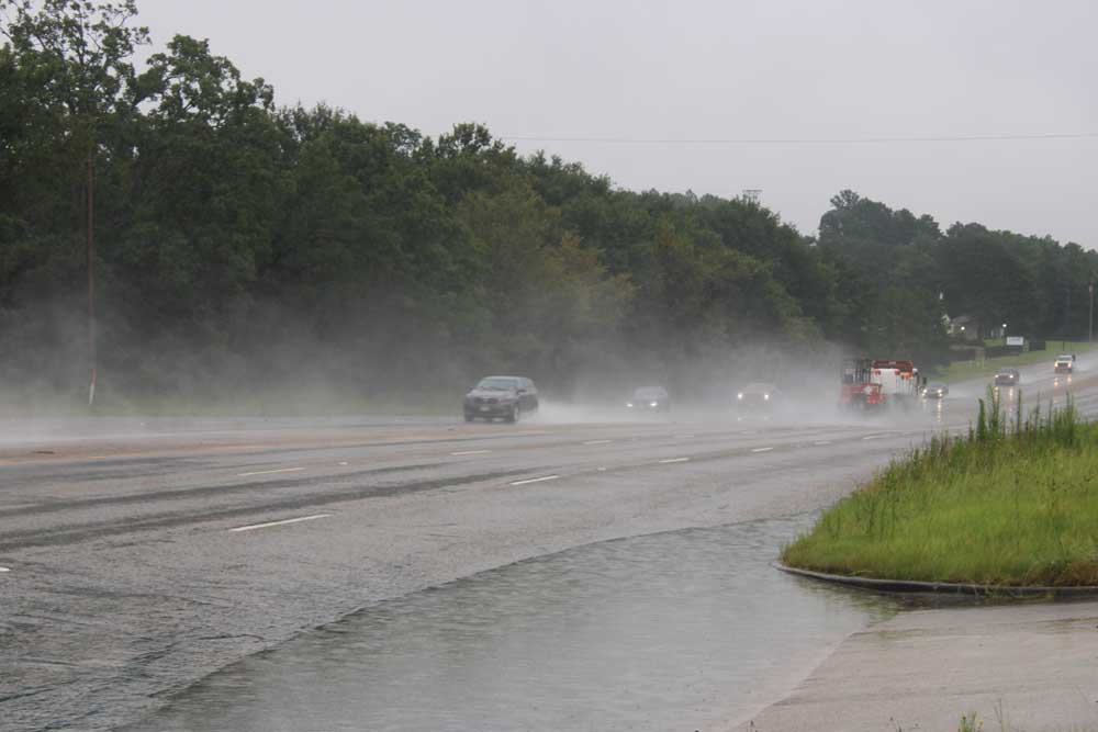
- Officials of Smith County are urging drivers not to drive into high water. (Jennifer Scott/Tyler Morning Telegraph)
Nearly 5 inches of rain fell in Tyler on Monday and the region experienced high wind gusts as Tropical Storm Beryl rolled through the region. Nearly 1,500 remained without power in Smith County as of Tuesday afternoon.
Tornado watches and flood warnings were issued throughout most of East Texas, including Smith, Gregg, Upshur, Cherokee, Harrison, Marion, Rusk, and Panola counties, according to the National Weather Service in Shreveport. Tornado warnings had also been issued Monday for multiple areas of East Texas.
“Today’s weather events across our region in the wake of Hurricane Beryl’s remnants are further proof that inland tropical impacts can also be quite extreme,” NWS Shreveport said in a statement. “A total of 67 tornado warnings were issued across NWS Shreveport’s coverage area, easily the most in a single day event.”
8:35 a.m. Wednesday
Power has been restored to nearly all homes/businesses in Smith County.
Click here for the latest Oncor outage map.
8:12 p.m. Tuesday
Power has been restored to over 3,500 residences and businesses in Smith County, but about 170 are still without power.
Oncor is reporting the following outages in East Texas counties:
Smith: 169
Anderson: 519
Cherokee: 704
Henderson: 55
There is no estimated time for restoration. View the latest Oncor outages here.
2:30 p.m.
“Oncor teams continue working to make repairs and restore power for customers in the Eastern part of our territory, impacted by the landfall of Tropical Storm Beryl,” Oncor said in a statement. “The storm brought thunderstorms and tornado warnings with high winds and heavy rain, resulting in damage to Oncor poles and wires and also localized flooding, causing some difficulty in gaining access to make repairs.
“We greatly appreciate the patience and understanding of our customers and are focused on doing all we can to restore the remaining outages as quickly and safely as possible.
“Safety for our teams and the public remains Oncor’s number one priority. If you see a downed power line, please stay away, keep pets and others away and call 911 immediately. In addition to the downed line potentially being energized, anything touching the power line, such as a tree branch, could also be energized. Please do not touch the power line or anything else touching it.”
To report a power outage or check the status, text OUT to 66267, use the MyOncor app, click “Report an Outage” on the map, or call 888-313-4747.
Oncor is reporting the following outages in East Texas counties:
Smith: 1,449
Anderson: 965
Cherokee: 1,145
Henderson: 122
Rusk: 37
There is no estimated time for restoration. View the latest Oncor outages here.
10:20 a.m.
Oncor is reporting the following outages in East Texas counties:
Smith: 2,236
Anderson: 1,576
Cherokee: 1,329
Henderson: 156
Rusk: 52
There is no estimated time for restoration. View the latest Oncor outages here.
“We are currently monitoring a storm system moving across parts of the service area due to the landfall of tropical storm Beryl. Resources are available and will be working to restore power as needed in these areas,” Oncor said in a statement.
To report an outage text OUT to 66267, use the MyOncor app, or select “Report an Outage” located above the map here.
“Safety for our employees and the public is our number one priority,” Oncor said. “If you see a downed power line, stay away and call 911 immediately.”
Smith County update
Smith County officials say the county fared well Monday compared to the severe weather that was forecast to come through the area with Beryl.
Although Smith County was included in several tornado watches and warnings and flash flood warnings by the U.S. National Weather Service of Shreveport, the more severe weather stayed east of the area.
Smith County roads had a few trees down Monday afternoon and evening, but all have been cleared as of Tuesday and there are no new road closures at this time.
Smith County first responders had about 50 calls for service, due to downed trees or utility issues and there are about 4,000 people in Smith County without power as of Tuesday morning.
City of Tyler update
The City of Tyler has received 10 reports of downed trees blocking roadways. Residents are asked to avoid all non-essential driving. If you must drive, slow down. If you see water over the roadways, turn around.
The following streets/intersections have one or more lanes closed due to downed trees or power lanes:
- West 8th Street and South College Avenue
- North Parkdale Drive and Lynn Drive
- Belvedere Boulevard and Woodlawn Street
- Shiloh Road and Paluxy Drive
- Woodland Hills Drive and Cloverdale Drive
- Woodland Hills Drive and Peggy Place
- Amy Lane and Gail Lane
- 1903 N. Forest Ave.
- 320 S. Vine Ave.
- 421 W. Harpole St.
The Street Department is actively working on clearing streets and will continue as long as conditions are safe.
FEMA
FEMA informs the Disaster Recovery Center for Smith County at The Hub is closed until further notice. For more information and updates, visit FEMA Region 6 on Facebook.
11:15 p.m.
Oncor is reporting the following outages in East Texas counties:
Smith: 3,675
Anderson: 2,316
Cherokee: 1,927
Henderson: 189
Rusk: 25
There is no estimated time for restoration. View the latest Oncor outages here.
“We are currently monitoring a storm system moving across parts of the service area due to the landfall of tropical storm Beryl. Resources are available and will be working to restore power as needed in these areas,” Oncor said in a statement.
To report an outage text OUT to 66267, use the MyOncor app, or select “Report an Outage” located above the map here.
“Safety for our employees and the public is our number one priority,” Oncor said. “If you see a downed power line, stay away and call 911 immediately.”
4:50 p.m.
All tornado warnings have expired in East Texas.
Heavy rain is expected to continue through the night.
4:39 p.m.
Oncor is reporting the following outages in East Texas counties:
Smith: 3,133
Anderson: 3,756
Cherokee: 2,517
Henderson: 57
Rusk: 71
There is no estimated time for restoration. View the latest Oncor outages here.
4:37 p.m.
The tornado warning impacting Smith County has been dropped. It was originally in effect through 5 p.m.
4:22 p.m.
City of Tyler urges residents to be weather alert, avoid non-essential travel
The National Weather Service has issued a Tornado Watch and Flood Warning for Tyler until 10 p.m. due to storm Beryl.
The City of Tyler is advising its residents to be cautious and aware of downed trees and power lines and avoid all non-essential driving. If you must drive, slow down. If you see water over the roadways, turn around.
The City of Tyler offers residents a free emergency alert system through Smart 911 with RAVE Alert. Signing up for alerts is easy. Follow the RAVE Alert link and create your Smart911 account. You will then be able to select which alerts from the City of Tyler, Smith County, and surrounding areas you would like to receive. Account users may sign up to receive email and text message alerts. In addition, users may opt to provide additional information. This gives first responders access to critical information on how best to respond to your family’s needs in an emergency situation. All information is secure and will not be shared publicly.
Cooling, charging centers
Tyler Public Library is open Monday through Thursday from 10 a.m. to 7 p.m., Friday from 10 a.m. to 6 p.m., Saturday from 10 a.m. to 5 p.m., and Sunday from 1 to 5 p.m.
Tyler Senior Center is open Monday through Friday, 9 a.m. to 5 p.m.
Glass Recreation Center is open Monday through Friday, 7 a.m. to 10 p.m., and Saturdays from 9 a.m. to 5 p.m.
Tyler Fire Department
Portable generators can be life-saving tools during emergencies but can become deadly if misused through the accumulation of carbon monoxide fumes. Year after year, people suffer carbon monoxide poisoning due to improper usage of portable generators.
FEMA
FEMA’s Disaster Recovery Center in Smith County is closed Monday. Go to FEMA’s Region 6 Facebook to check their business hours for Tuesday.
Roadways
Residents can report flooded streets, potholes, sinkholes, downed trees, stormwater issues, and drainage issues using the free “MyTyler” phone App or by calling the Streets Department at (903) 531-1393 from 8 a.m. to 5 p.m. Monday through Friday and the Tyler Police Department non-emergency number at (903) 531-1000 during non-business hours.
Report downed power lines to Oncor at 1-888-313-4747. Do not attempt to move the lines or trees if power lines are involved.
Tyler utilities
All essential City Services, including water and wastewater services, will continue to operate at full capacity.
Contact Oncor at 1-888-313-4747 to report power outages.
City of Tyler traffic signals
Intersections without power or flashing red lights should be treated as all-way stops.
Solid waste in Tyler
Solid Waste will continue to operate during its normal business hours until further notice.
Tyler Transit
Tyler Transit will continue to operate during its normal business hours until further notice.
4:15 p.m.
Tornado warning issued until 5 p.m. for the northeastern part of Smith County including Winona.
3:25 p.m.
Oncor is reporting the following outages in East Texas counties:
Anderson: 4,783
Cherokee: 3,291
Henderson: 121
Smith: 1,354
There is no estimated time for restoration. View the latest Oncor outages here.
3:15 p.m.
Flash flood warning issued for Smith County until 6:15 p.m.
2:40 p.m.
CBS19 Chief Meteorologist Brett Anthony says this type of storm system could stretch over up to eight hours. He expects the worst of the storm to move past the Tyler area by 7 p.m. As of now, it is only raining in Tyler but the possibility of more rotations to spin up is possible now through 10 p.m., when the tornado watch is set to expire. Rotations can spin up quickly, Anthony added.
2:25 p.m.
Power outages began to impact the region Monday afternoon. Oncor is reporting the following outages in East Texas counties:
Anderson: 3,679
Cherokee: 2,357
Henderson: 1,205
Smith: 788
There is no estimated time for restoration. View the latest Oncor outages here.
2:15 p.m.
Flights canceled at area airports
Flights into the Tyler airport were canceled Monday afternoon as Tropical Storm Beryl snarls airline traffic across the state.
A 4:20 p.m. flight into Tyler Pounds Field were canceled. However, flights later in the day were still set to arrive on time.
More than 1,000 flights in Texas have been canceled in Texas, the Associated Press reported.
No reports of damage have been made at the airport, officials said.
Earlier reporting:
Smith and Cherokee counties were previously impacted by a tornado warning which expired at 1:45 p.m.
When a tornado warning is issued, people in the area should take shelter in basements or interior rooms on the lowest levels of their homes. People who are outdoors, in a mobile home or in a vehicle should move to the closest substantial shelter. People should also protect themselves from flying debris.
The region has a “good chance” to experience tornadoes Monday, Brandon Thorne, a meteorologist with the National Weather Service in Shreveport, said earlier Monday. Outer bands of the tropical storm that have resulted in tornado warnings are working their way into the region.
Local tornado watches are expected to end at 10 p.m. Monday, while flood warnings will remain in effect through Tuesday afternoon.
People throughout the region should have safety plans in place in the event of a tornado, Thorne said.
The region could experience gusts of wind of up to 40 and 50 miles per hour, Thorne said. The onset of severe storms was expected to begin between 10 a.m. and noon, but CBS19 predicts rain could continue for up to 30 hours.
Upper East Texas had received between a half-inch and an inch of rainfall as of Monday afternoon, Thorne said. However, some isolated parts of the region had higher rainfall.
Rainfall continued throughout the region Monday morning. In a Facebook post, Smith County urged drivers not to drive into high water. An up-to-date county road closure map can be found by visiting www.smith-county.com and clicking on the “County Road and Office Closures” tab under citizen resources.
Flash flooding could pose problems for drivers, said Jeff Williford, public information officer for the Texas Department of Transportation’s Tyler District.
State road crews are ready to respond to problems arising from the weather, such as downed trees, Williford said.
The National Weather Service urges people to turn on wireless emergency alerts on their cell phones. Those alerts can be enabled through a phone’s settings.
The tropical storm made landfall along the Texas coast Monday morning and is expected to leave Upper East Texas by Tuesday afternoon, according to the National Weather Service.
The remnants of the storm entered the Smith County area beginning around 10 a.m. Monday. Heavy rain is expected to continue as Beryl moves through the region. The environment is supportive of severe storms, the NWS says, noting tornadoes and damaging winds as the main threats.
The NWS said Beryl had strengthened as of Sunday and additional strengthening occurred after Beryl made landfall as a Category 1 hurricane along near Matagorda on Monday morning. Later Monday morning, the storm weakened to a tropical storm.
Parts of East Texas could see wind gusts close to tropical storm force or just under that Monday evening into overnight Tuesday.
Winds gusting up to 45 mph could knock down trees weakened by past wind events or the heavy rain that comes with the remnants of Beryl.
Acting Gov. Dan Patrick this weekend urged Texans to make final preparations and announced that he added 81 counties to the state’s Beryl Disaster Declaration as storm forecasts have shifted the expected landfall north and east of previous projections.
This brings the total number of Texas counties included in the state’s disaster declaration to 121 counties. Among those is Smith, Wood, Van Zandt and other East Texas counties.
“Based on the current forecast, heavy rain and some localized flooding could occur all the way from the coast through areas near College Station, Tyler, and Texarkana as the storm moves through Texas on its current track,” Patrick said in a press release. “The track may change over the next 40 hours. Texans need to take heed, watch their local officials, and prepare (Saturday and Sunday) before the storm makes landfall early Monday morning.
“As Acting Governor, I’ve been in constant communication with Texas state agencies and local leaders to coordinate preparations and response, and I will continue to do so. Do not ignore this storm,” he said.
The 81 Texas counties added include Anderson, Angelina, Austin, Bastrop, Bell, Bowie, Brazoria, Brazos, Burleson, Caldwell, Camp, Cass, Chambers, Cherokee, Collin, Colorado, Comal, Dallas, Delta, Ellis, Falls, Fannin, Fayette, Fort Bend, Franklin, Freestone, Galveston, Grayson, Gregg, Grimes, Guadalupe, Hardin, Harris, Harrison, Hays, Henderson, Hill, Hopkins, Houston, Hunt, Jasper, Jefferson, Kaufman, Lamar, Lee, Leon, Liberty, Limestone, Madison, Marion, McLennan, Milam, Montgomery, Morris, Nacogdoches, Navarro, Newton, Orange, Panola, Polk, Rains, Red River, Robertson, Rockwall, Rusk, Sabine, San Augustine, San Jacinto, Shelby, Smith, Titus, Travis, Trinity, Tyler, Upshur, Van Zandt, Walker, Waller, Washington, Williamson, and Wood counties. Additional counties may be added as conditions warrant.


-
eEdition
-
-
