Severe weather to approach East Texas this afternoon before clearing out
Published 11:16 am Wednesday, April 13, 2022
- wx use.jpg
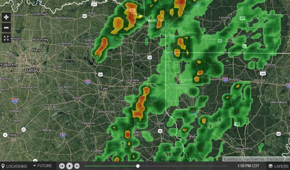
Local weather experts expect thunderstorms to be cleared out of East Texas by 6 p.m. tonight, but it is important for residents to remain weather aware until then as watches and potential warnings are issued.
Our CBS19 partner meteorologist Chandlor Jordan said attention is on another line of thunderstorms which recently prompted a tornado watch to be issued for Smith and Gregg counties and surrounding areas in East Texas.
The watch is in effect until 5 p.m. this evening and Jordan said all types of severe weather are possible with this next line of storms expected to arrive in East Texas from 1 and 6 p.m.
Impacts could include damaging wind gusts, large hail and isolated tornadoes.
“There is not as widespread of a chance as Tuesday evening, but there’s still a pretty sizable threat that should be respected the same as last night’s threat,” Jordan said, adding residents should remain weather aware and take all advisories seriously.
Jordan predicts the next line of storms will approach the Smith and Gregg county areas between 3 and 4 p.m. this afternoon.
By 6 p.m., Jordan said all storms will have passed through East Texas and moved out of the area.
“It’s still important for residents who are commuting home from work around that time to be very careful and remain weather aware,” Jordan said, asking residents to check any active weather alerts before driving home and taking extreme caution on the roads.
Jordan said the forecast is showing Thursday and Friday to be “gorgeous” days, with a high of 78 on Thursday and a high of 81 on Good Friday.
Stay tuned with the latest weather and storm damage updates here.


-
eEdition
-
-
