East Texas experiences severe weather threat
Published 9:00 pm Monday, March 21, 2022
- nws.png
Severe weather is expected to continue on Tuesday in East Texas, experts said, after the area experienced heavy rain, flooding, strong winds and powerful storm cells on Monday evening throughout the night.
Areas of East Texas saw severe weather throughout the night Monday into Tuesday morning. The threat will continue through at least Tuesday afternoon, according to the National Weather Service in Shreveport.
As rain continues, experts urge residents and motorists to be aware of heavy water Tuesday morning; however, motorists are advised to never drive through flooded roadways.
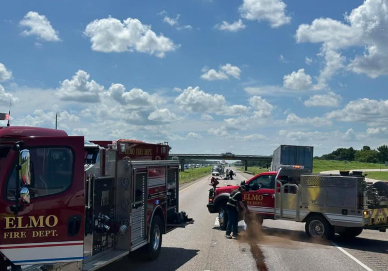
Due to the heavy rain, numerous roadways in Tyler are flooded and impassable, officials said on Tuesday around 12:30 a.m. Tyler police and fire were responding to vehicles stalled in the roadway overnight.
Due to the continuing rain, officials advise motorists to watch out for flooded areas and reiterate not to pass through flooded roadways. Drive at speeds that are safe for the conditions, which at this time are lower than the posted speed limits. Tyler police will continue to update road conditions as they change.
Smith County was under tornado and severe thunderstorm warnings on Monday night and into early Tuesday, but both expired.
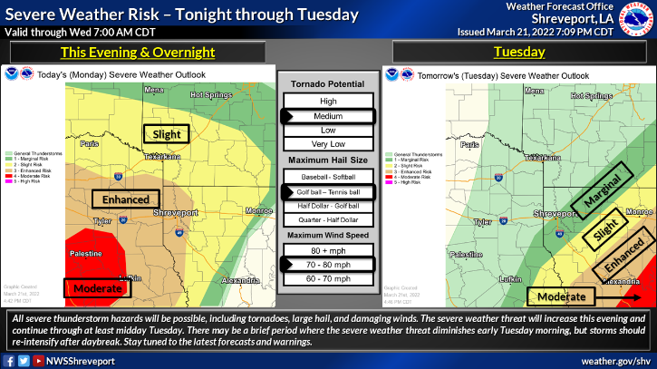
According to NWS, all severe thunderstorm hazards could be possible, including tornadoes, large hail and damaging winds. The severe weather threat is forecast to continue through at least midday Tuesday.
“There may be a brief period where the severe weather threat diminishes early Tuesday morning, but storms should gradually re-intensify after daybreak,” NWS said on its Twitter.
According to NWS, Tyler and Longview were both in the “enhanced” risk region, or 4 on a scale 0 to 5, on Monday. The potential for a tornado is “medium” with winds expected to be about 70 to 80 mph and hail could be the size of golf balls, according to NWS.
The threat will move east on Tuesday with Tyler and Longview’s risk level decreasing.
For those who live in a mobile home or RV, the NWS advises residents to consider moving to a safer place before severe weather threats are issued.
“… Make arrangements to go to a safe, sturdy structure BEFORE warnings are issued,” NWS wrote on its Twitter. “Arrange with friends/neighbors now, a nd make your move when (a) WATCH is issued.”
National Weather Service Meteorologist Gary Chatelain on Friday said this weather is to be expected because March through April are the busiest times for tornadoes. According to the Texas Almanac, tornadoes can occur in any month and at any hour of the day, but they occur with greatest frequency during the late spring and early summer months between 4 and 8 p.m.
Over the weekend, the area saw temperatures that Chatelain said would be “unseasonably warm.”
“That’s what adds to the severity of the warm Gulf air that’s gonna be lifted by the storm, and it may stretch thunderstorms into dangerous supercells,” Chatelain said on Friday.


-
eEdition
-
-
