Arctic front to bring cold temperatures to East Texas
Published 10:30 am Friday, January 17, 2025
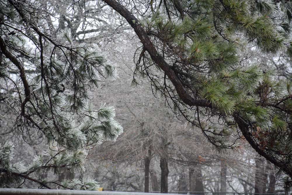
- Ice accumulates on tree branches along a Smith County road in Chapel Hill on Jan. 31, 2023. Cold, wet conditions are forecast for Tyler next week. (Santana Wood/Tyler Morning Telegraph File)
A cold front is forecast to move into East Texas early next week.
“The arctic front arrives late Friday night, and moves through East Texas Saturday morning, and the cold air kind of lags behind it,” CBS19 Chief Meteorologist Brett Anthony said. “Saturday afternoon, about four or five o’clock is the leading edge of it, you really start to feel it.”
South winds, breezy at 10 to 15 mph on Friday, are expected to help push temperatures up to around 64 degrees. By Friday afternoon, there is a chance of scattered showers ahead of an approaching arctic front.
A significant temperature drop will hit Saturday, which will see mostly sunny skies with highs in the mid-50s and lows in the mid-20s. By Sunday morning, temperatures will plummet to 25 degrees. With an average high of 58 degrees, daytime highs will be about 20 degrees below normal.
Monday is expected to be partly cloudy with highs in the mid-30s and lows in the low 20s. On Tuesday, with highs in the mid-30s and lows in the mid-20s, there is a chance of morning snow showers, depending on the storm’s track.
One scenario suggests a steady area of light snow could develop Tuesday morning and continue through the afternoon. Another possibility is the storm tracking closer to Houston, which would result in only a few flurries for East Texas.
As of Friday, the National Weather Service of Shreveport predicted Tyler, Longview and southern areas of East Texas as having a 15 to 25% chance of winter precipitation accumulation.
Still, it’s a bit too soon to tell.
“A chance for wintry precipitation next week remains over the area,” NWS said Friday morning. “The highest chance will be south of the I-20 corridor, but even those chances are less than 50 percent. Lots of uncertainty still remain with this upcoming system, so continue to monitor the forecast for updates.”
The NWS said it’s important to keep in mind the potential weather event is still a few days out, so probabilities for “even light snow could decrease in this time period.”
Potential of significant snow accumulation is generally highest south of I-20, although even in those areas the chances are currently slight. A reasonable worst case scenario, NWS said, of significant snowfall would cause travel impacts given cold ground and efficient road accumulation.
The upcoming cold snap is driven by what’s known as cross-polar flow, with frigid air originating in Siberia. Global winds are steering this air mass over the North Pole, through Canada, and down into Texas.
Unlike a week ago, when cold air arrived without significant modification, this time the air is moving over a snow-covered landscape.
Snow on the ground— stretching from North Central Kansas through Nebraska and South Dakota — limits how much the air mass can warm as it travels south. Without snow, the air would modify more significantly, but the presence of snow ensures it retains much of its chill.
While temperatures won’t reach the extreme lows seen near the Canadian border, this air mass will still bring cold conditions to East Texas, with temperatures dipping into the teens and low 20s — well below average for this time of year, Anthony said.
When the chilly temperatures get here, mornings in Tyler could see lows around 21 degrees, while Longview may see a low of 19 degrees. Both cities are expected to reach daytime highs near 33 degrees, staying within one or two degrees of each other.
“Cold wind chill values will begin as early as Sunday (morning) as a frigid airmass arrives. This theme will continue for Monday (morning) as similar wind chill values are expected to exist,” NWS said Friday. “It will be crucial to limit time outdoors to decrease the risk of cold weather-related illness.”
The Tyler and Longview areas will see wind chills of 10 to 15 degrees.
Cold weather poses a risk to outdoor and indoor pipes, so it’s important for residents to take precautions. In the days leading up to the freezing temperatures, NWS said residents’ priorities should be on making sure their homes are winterized.
They should leave cabinets open and let faucets drip slightly to prevent freezing. If plants haven’t been brought inside already, they may not survive the cold snap, and pets should definitely be kept indoors during the freeze.
If snow falls, it’s advised to limit outdoor playtime for pets and children to reduce exposure to the harsh conditions.
Additionally, it’s recommended to winterize vehicles by checking the antifreeze level and ensuring the battery is in good condition, as extreme cold can drain battery power. Drivers should also top off their windshield wiper fluid in case of slush or melting snow on the roads.
NWS advises residents to continue to monitor the forecast over the next several days to stay up to date with any changes. The weather service also suggested to rely on trusted sources, such as NWS Shreveport and local media outlets, for up-to-date weather information.
Although the temperatures will be below freezing into next week, Anthony said warmer temperatures will return within a matter of days.
“The daytime highs recover above freezing both days,” Anthony said. “It’s not a repeat of 2021, by next Thursday, we’re back in the 40s. So it’s a pretty quick thaw.”


-
eEdition
-
-
