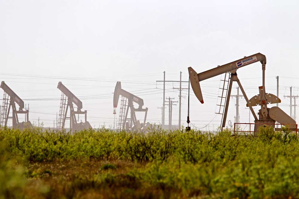
Drilling report: Oct. 27-Nov. 2, 2024
Published 5:00 am Wednesday, November 20, 2024
- Latshaw Drilling Rig
DRILLING
County Operator Lease/Well Field Survey Type Depth Location
Freestone Hilcorp Energy Company Milner/1 Teas Martin, I gas 8980 2.5 miles east of Streetman
Freestone Hilcorp Energy Company Northen Gas Unit/6 Reed Karn, J. oil or gas 9900 3.2 miles southwest of Fairfield
Freestone Hilcorp Energy Company Northen Gas Unit/4 Reed Karn, I.H. gas 9896 3.2 miles southwest of Fairfield
Harrison TGNR East Texas II LLC. Riley-Rogers HV Unit B/2H Carthage (Haynesville Shale) Anderson, H. gas 13000 7.5 miles northwest of Waskom
Harrison TGNR East Texas II LLC. Hammond Estate HV Unit D/4H Carthage (Haynesville Shale) Holloway, S. gas 13000 3.5 miles southwest of Waskom
Harrison TGNR East Texas II LLC. Hammond Estate HV Unit E/5H Carthage (Haynesville Shale) Holloway, S. gas 13000 3.5 miles southwest of Waskom
Harrison TGNR East Texas II LLC. Vaughan-Jonesville HV Unit A/1H Carthage (Haynesville Shale) Clinton, J. gas 13000 5 miles northwest of Waskom
Henderson Atmos Pipeline Texas Tri-Cities Gas Storage Unit/358H Tri-Cities Wiley, Kay storage well 7650 7.5 miles southwest of Athens
Nacogdoches Exco Operating Company LP. Walker SU K Alloc A/1H Carthage (Haynesville Shale) Kuykendall, A. gas 15500 6.2 miles southwest of Chireno
Navarro Phillips 66 Pipeline LLC. SEAW400C-114/1 Wildcat McDaniel, J.B. cathodic protection well 300 7.31 miles northwest of Silver City
Panola Diversified Production LLC. Tatum B-Holly/2H Brachfield, S.E. Cotton McAdams, J. gas 9864 4.5 miles east of Brachfield
Smith Faulconer Energy LLC. Waldrop TP/4 Overton Miller, J. oil or gas 12150 1 mile north of Troup
COMPLETIONS
County Operator Lease/Well Field Depth Flow Rate (42 Hrs.) Choke Size Location
Gregg Buffco Production Inc. Mackey, L.L./2 Willow Springs 10921 N/A N/A 1 mile north of Longview
Harrison Natural Gas P/L Co. of Amer LLC. Huffman Gas Unit/1T Lansing, North 7421 N/A N/A 8 miles northeast of Longview
Harrison Natural Gas P/L Co. of Amer LLC. Suggs Gas Unit/1 Lansing, North 7375 N/A N/A 8 miles northeast of Longview
Harrison Natural Gas P/L Co. of Amer LLC. Still Gas Unit B/1B Lansing, North 7372 N/A N/A 8 miles northeast of Longview
Harrison Natural Gas P/L Co. of Amer LLC. Still Gas Unit A/1A Lansing, North 7900 N/A N/A 8 miles northeast of Longview
Harrison Natural Gas P/L Co. of Amer LLC. Isam Gas Unit/1 Lansing, North 7994 N/A N/A 8 miles northeast of Longview
Harrison Natural Gas P/L Co. of Amer LLC. Keasler, K./2A Lansing, North 7050 N/A N/A 8 miles northeast of Longview
Harrison Natural Gas P/L Co. of Amer LLC. Clements, V.A./32 Lansing, North 7050 N/A N/A 8 miles northeast of Longview
Harrison Natural Gas P/L Co. of Amer LLC. Keasler, J.K. 1/46IW Lansing, North 7045 N/A N/A 8 miles northwest of Hallsville
Harrison Natural Gas P/L Co. of Amer LLC. Clements, M.S. 2/47IW Lansing, North 7125 N/A N/A 8 miles northwest of Longview
Harrison Natural Gas P/L Co. of Amer LLC. Davis, Ina/27 Lansing, North 7050 N/A N/A 8 miles northeast of Longview
Marion Rose City Resources LLC. Crystal Cove/1 Whelan, North 3600 N/A N/A 6 miles north of Harleton
Panola RFE Operating LLC. Beckville-TXU Tatum GU1/1H Beckville 10408 N/A N/A 2.1 miles northeast of Tatum
Panola Sheridan Production Co. III LLC. Thompson Unit/6 Carthage 9675 39 22/64 2.6 miles northeast of Carthage
Robertson Wildfire Energy Operating LLC. Ring A/1HA Giddings 5875 N/A N/A 5.3 miles northwest of Mumford
Shelby Silver Hill Energy Operating LLC. USA Cothrom Unit 01/1H Carthage (Haynesville Shale) 11922 N/A N/A 5.1 miles southeast of Shelbyville
Shelby Silver Hill Energy Operating LLC. USA Cothrom Unit T2/2H Carthage (Haynesville Shale) 12211 N/A N/A 3.9 miles southeast of Shelbyville
Shelby Silver Hill Energy Operating LLC. USA Cothrom Unit T3/3H Carthage (Haynesville Shale) 11791 N/A N/A 3.9 miles southeast of Shelbyville
Shelby Silver Hill Energy Operating LLC. USA Cothrom Unit T4/4H Carthage (Haynesville Shale) 12197 N/A N/A 4.3 miles southeast of Shelbyville
Smith D-S-B Properties LLC. Pool-TJ/1 Mount Sylvan 7665 N/A N/A 4 miles southwest of Mount Sylvan
Smith Maximus Operating LTD. Scull/1 Winona 7916 N/A N/A 13.19 miles east of Tyler
Smith Faulconer Energy LLC. Shaw/5 Good Omen 11910 N/A N/A 3.5 miles northwest of Troup
— The drilling report was produced with data from the Texas Railroad Commission from Oct. 27-Nov. 2 following counties were searched: Anderson, Angelina, Camp, Cass, Cherokee, Dallas, Ellis, Franklin, Freestone, Gregg, Harrison, Henderson, Houston, Kaufman, Leon, Limestone, Marion, Nacogdoches, Navarro, Panola, Rains, Robertson, Rusk, San Augustine, Shelby, Smith, Upshur, Van Zandt and Wood.


-
eEdition
-
-
